ISRO-NASA’s $1.5 Billion NISAR Satellite Launches to Transform Earth Science
- July 25, 2025
- 0

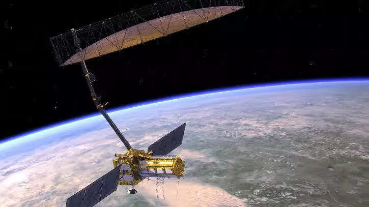
The Indian Space Research Organisation (ISRO) and the National Aeronautics and Space Administration (NASA) have embarked on a groundbreaking mission with the launch of the NISAR satellite. This joint venture, valued at $1.5 billion, marks one of the most expensive and technologically advanced collaborations between the two space agencies. The NISAR satellite is designed to monitor changes on Earth’s surface with unprecedented precision, promising to revolutionize our understanding of various geological and environmental phenomena.
Equipped with cutting-edge radar technology, NISAR will provide detailed observations of Earth’s surface. The satellite’s advanced radar systems are capable of scanning the planet every 12 days, offering consistent and comprehensive data. This frequent monitoring is crucial for tracking subtle changes in landforms, ice sheets, and vegetation, which can have significant implications for environmental research and policy-making.
One of the primary objectives of the NISAR mission is to enhance disaster prediction capabilities. By closely observing shifts in Earth’s surface, the satellite can help scientists anticipate natural disasters such as earthquakes, landslides, and volcanic eruptions. This predictive capability is expected to improve disaster preparedness and response strategies, potentially saving lives and reducing economic losses.
The collaboration between ISRO and NASA on the NISAR project exemplifies the power of international cooperation in advancing scientific knowledge. By pooling resources and expertise, the two agencies have developed a satellite that not only pushes technological boundaries but also strengthens diplomatic ties between India and the United States.
The data collected by NISAR will be invaluable for researchers studying climate change, ecosystem dynamics, and natural resource management. By providing high-resolution images and data sets, the satellite will enable scientists to conduct more accurate analyses of environmental changes over time. This could lead to new insights into how human activities impact Earth’s systems and inform sustainable development practices.