


Understanding Uttarkashi’s Vulnerability to Natural Disasters
- August 6, 2025
- 0


05, ANA Building, Sector 74, Phase 8B, Mohali, Punjab, India - 140308
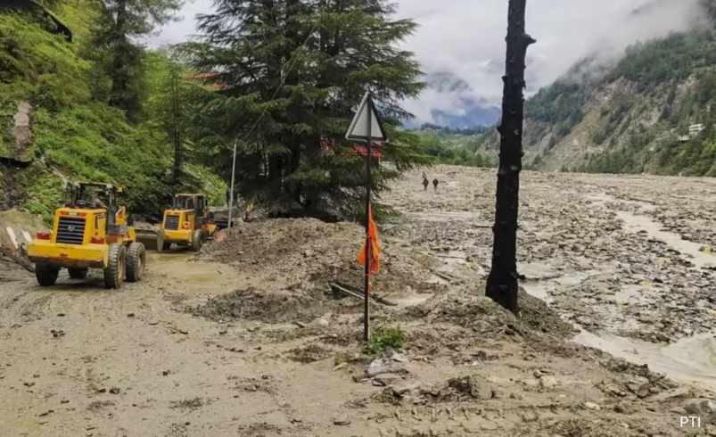
A devastating cloudburst in Uttarkashi district of Uttarakhand has resulted in the confirmed deaths of five individuals, with dozens still missing. The sudden flash floods and landslides have wreaked havoc in Dharali village near Harsil, destroying homes, hotels, and parts of an army camp. Rescue operations are ongoing as teams face challenging weather and terrain conditions while searching for survivors.
The region’s geography plays a significant role in its susceptibility to natural disasters. Located deep within the Garhwal Himalayas, areas like Dharali, Harsil, and Gangotri are prone to landslides and flash floods due to their steep mountain slopes, unstable rock formations, and a dense network of glacier-fed rivers. These factors, combined with human activities such as deforestation and unregulated development, exacerbate the area’s vulnerability.
Originating at Gaumukh from the Gangotri Glacier, the Bhagirathi River flows through several key locations including Gangotri, Harsil, and Uttarkashi. It merges with the Alaknanda River at Devprayag to form the Ganga. Despite Alaknanda carrying more water, Bhagirathi holds cultural significance as the main source of this sacred river.
Dharali is strategically located on NH-108 (Gangotri Road), surrounded by dense forests and situated at an altitude of 2,680 meters. Its proximity to Gangotri makes it a critical area for both tourism and religious activities.
Mukhba village serves as the winter home for the idol of Goddess Ganga when snow blocks access to Gangotri Temple. This tradition underscores the cultural importance of this region in Hindu customs.
Harsil is approximately 200 km from Dehradun and accessible via NH-34. The journey from Delhi ranges between 440 and 480 km, highlighting the region’s connectivity challenges during adverse weather conditions.